About Umatilla, Florida
The cool of dappled shade, a mockingbird chirping overhead, wild turkeys clucking in the distance – all are part of the soundtrack for the “Gateway to the Ocala National Forest.” Umatilla is that gateway and from her shoulders you can reach a million acres of pristine wilderness and cold, clear first magnitude springs for swimming, tubing and kayaking. Enjoy some of the best bass and speck fishing in the country on the 3,000 lakes in the area, and keep an eye out for white-tailed deer. Enjoy camping and explore museums, sports parks, award-winning restaurants and more. You’ll want to take lots of pictures so you can frame your memories of Umatilla and Lake County.
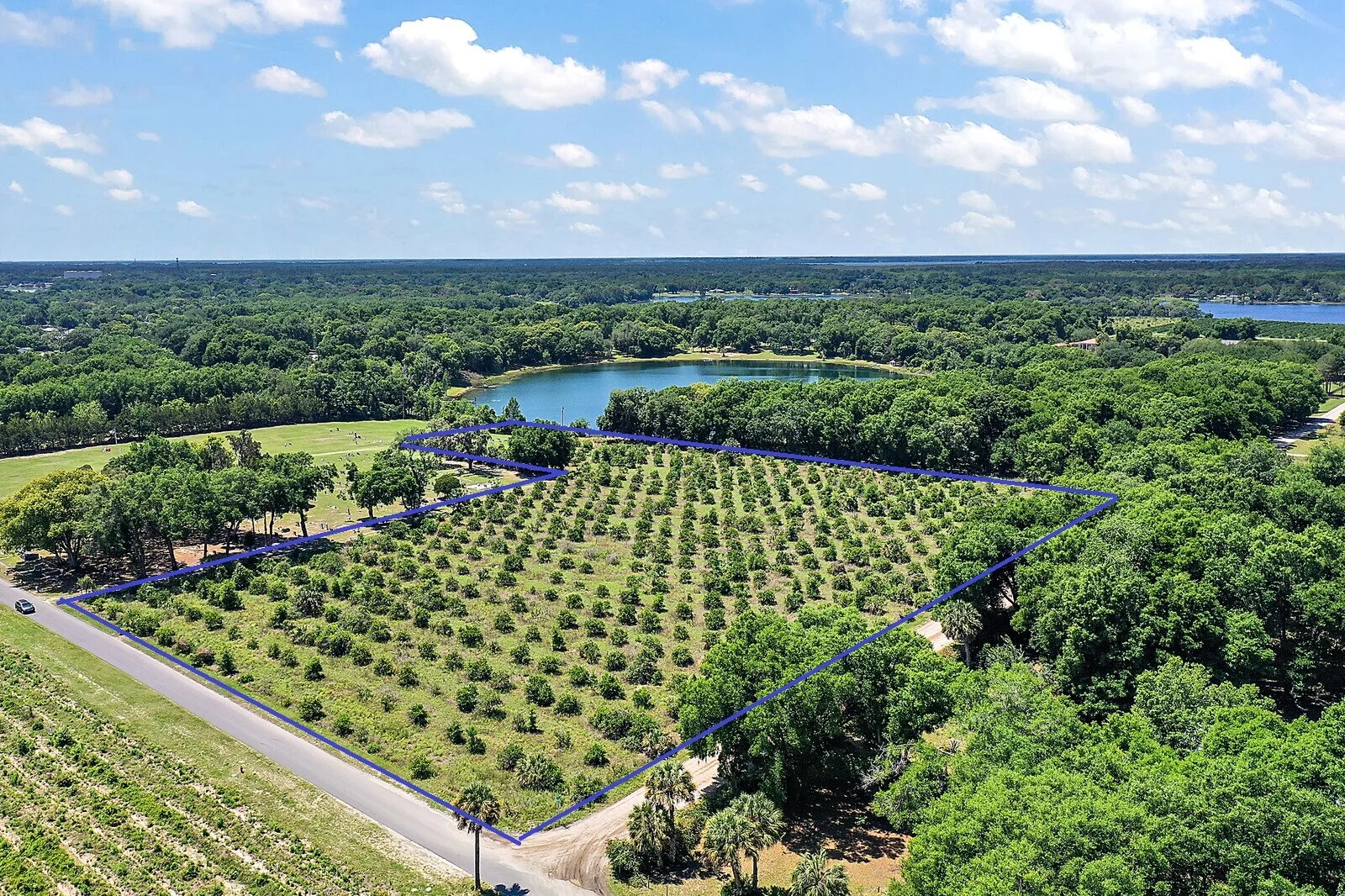
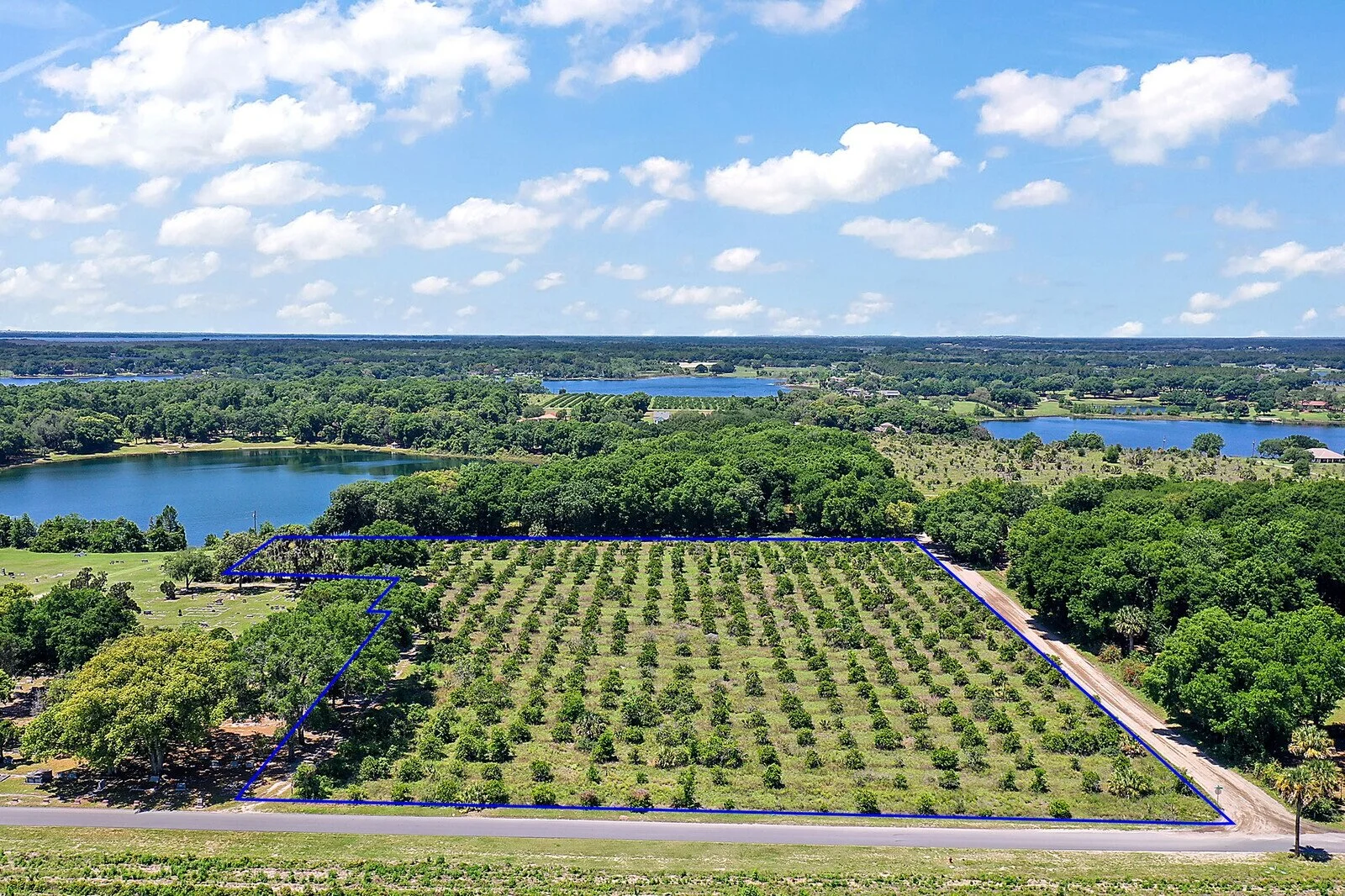
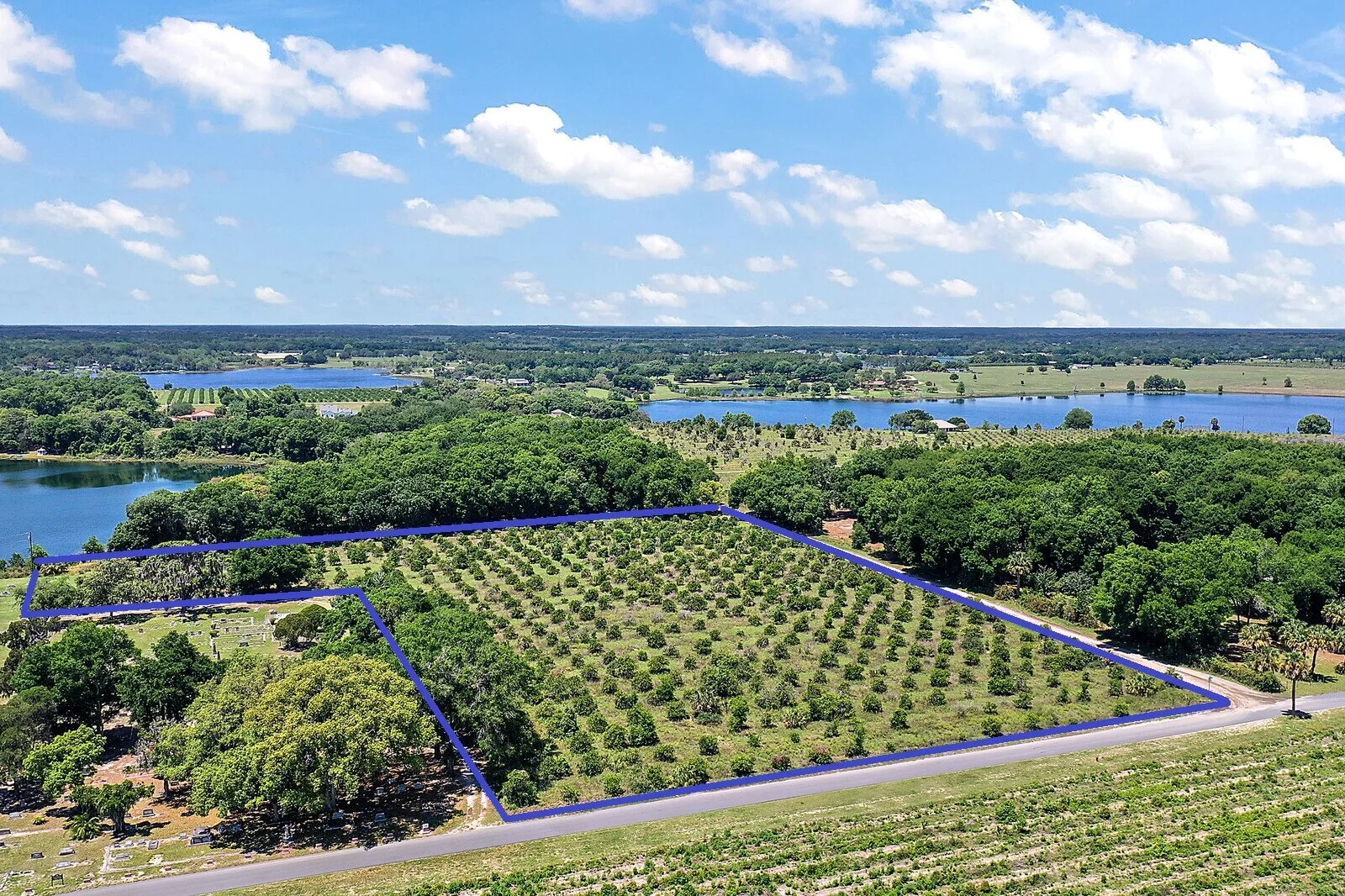
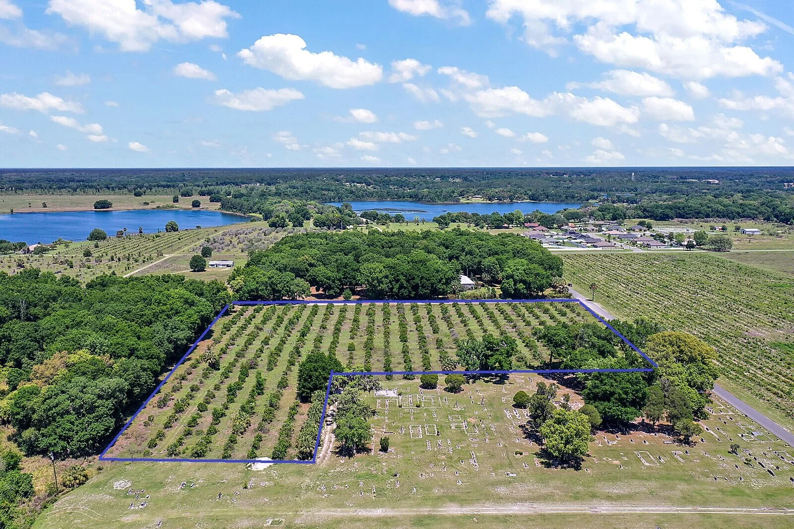
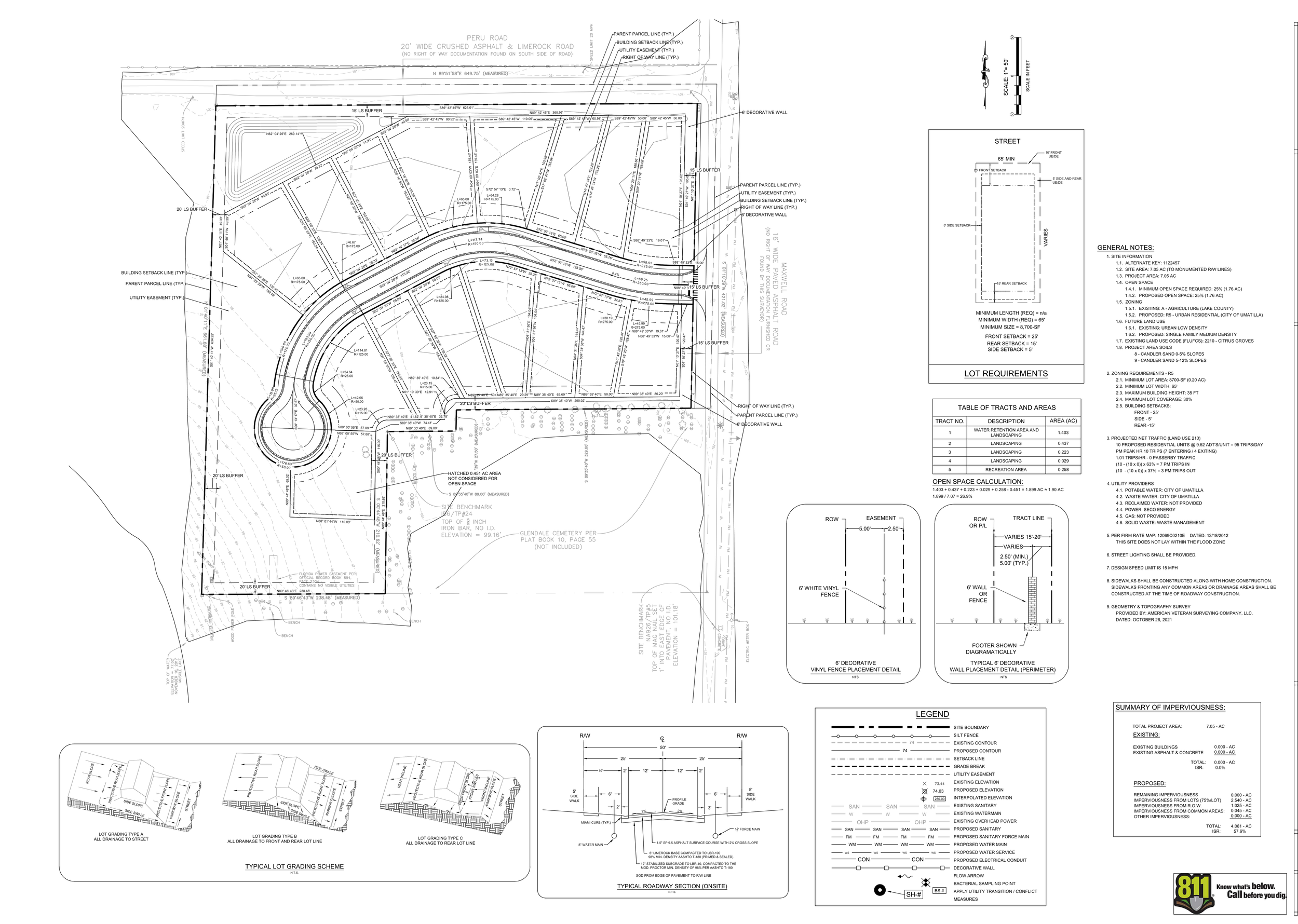
Total project area is 7.50 acres +/-, 326,700 sf +/-
Design District - Urban Low
Future Land Use Category - R5
Residential - 16 Single Family Homes
Gross Density 2.67 units/acre
Max Density 5 units/acre
Parks Space 1.76 acres
Required Parking - 2 spaces / unit
Open Space 3.6 acres (48%)
Water and Sewer from City of Umatilla
ENGINEERED SITE PLAN FOR 16 LOTS
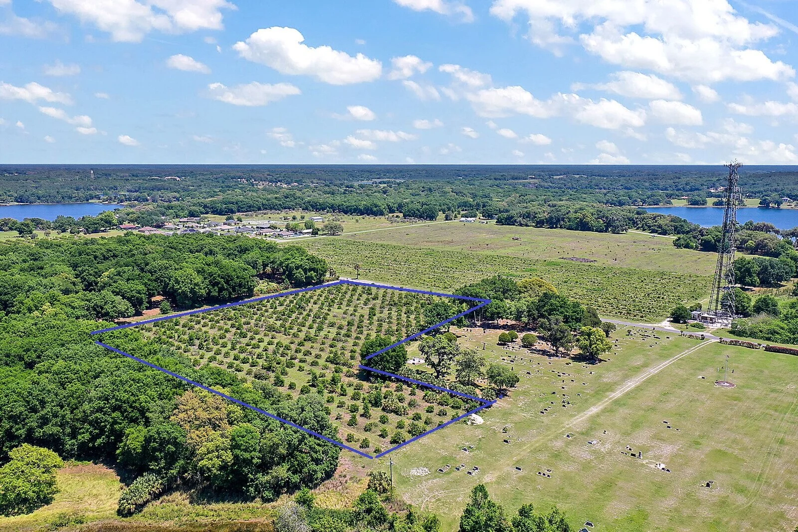
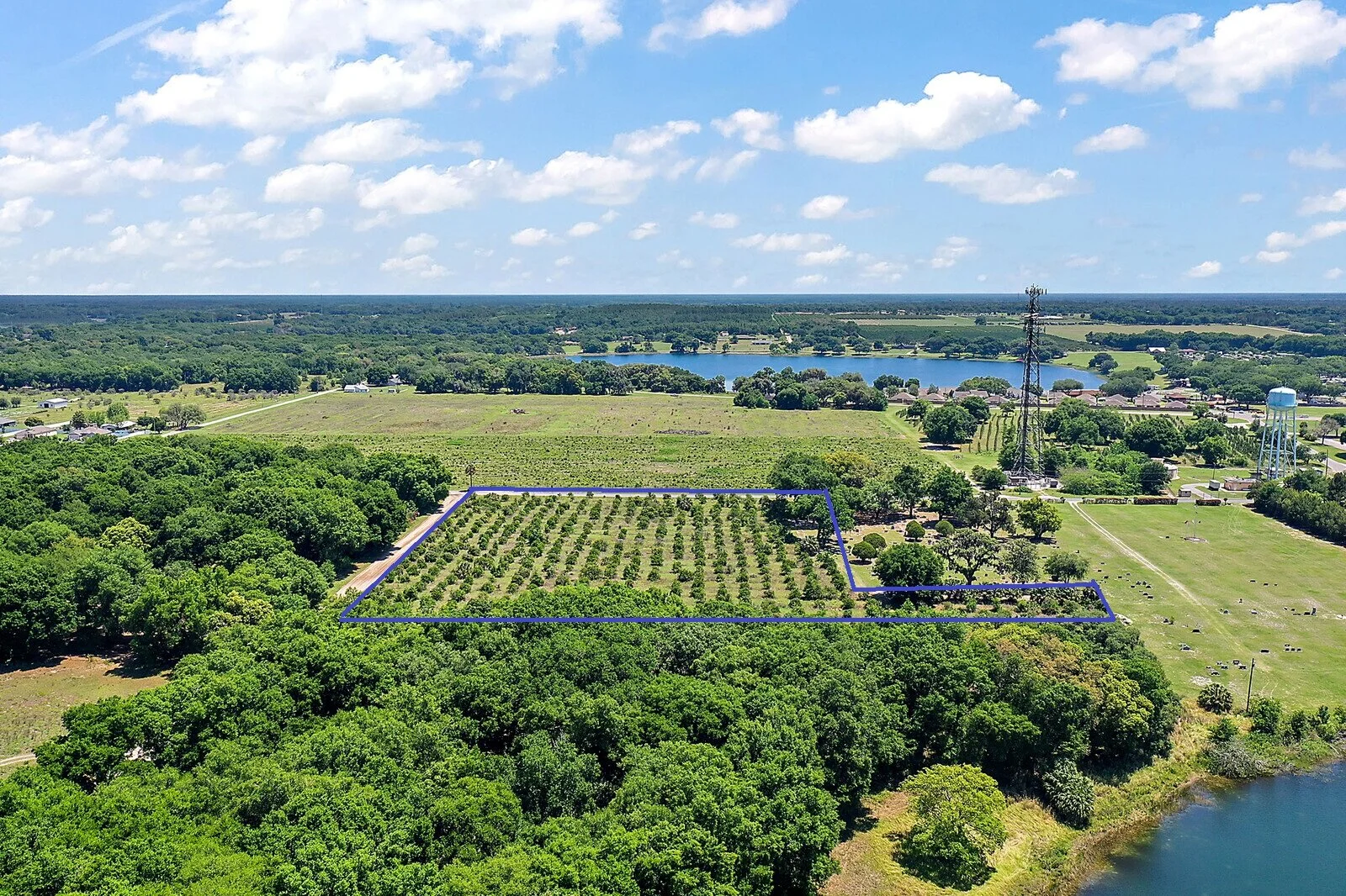
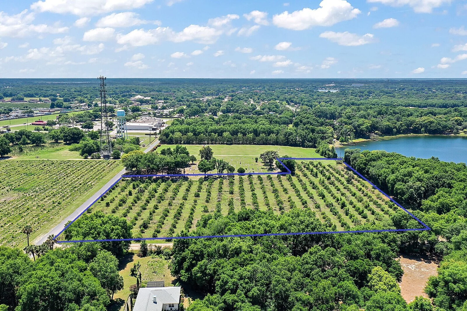
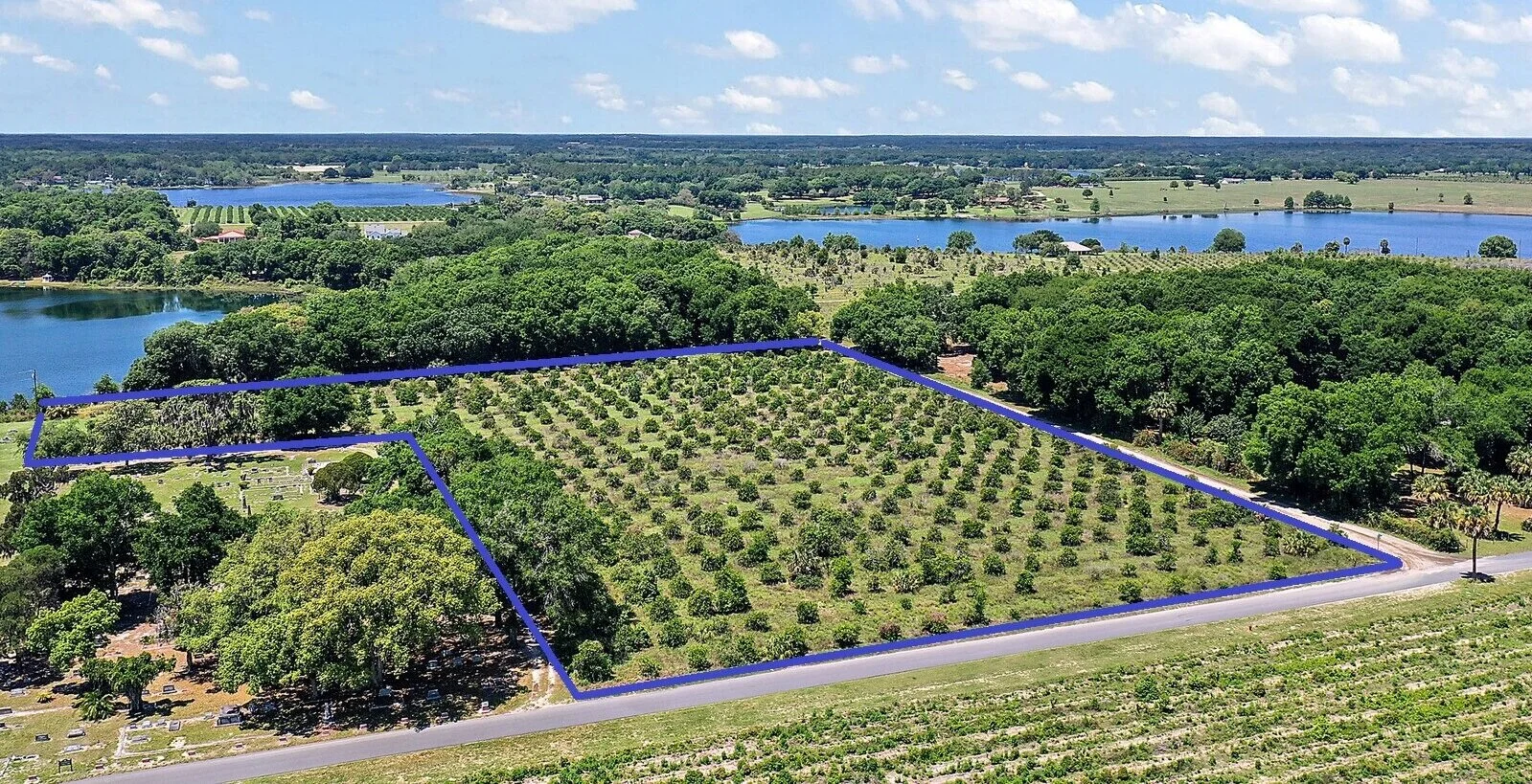
AERIAL DRONE PHOTOGRAPHS